
YELLOWMAPS
YellowMaps Burnsville NC topo map, 1:24000 Scale, 7.5 X 7.5 Minute, Historical, 1939, Updated 1956, 26.7 x 21.9 in - Tyvek
₪594.44
₪990.73
-
 Order within 4 hours and 38 minutes to get between July 6 - July 12
 -
 Tracked Shipping on All Orders
-
 14-Day Returns
- Secure Payments
-
 24/7 Customer Support
Description
- Printed on Tyvek (synthetic)
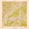
- USGS topographic map of Burnsville, NC, at 1:24000 scale. Lighter material. Waterproof. Tear-resistant. Foldable. Very durable. Perfect for backpacking and the outdoors.
- Cities, towns, villages: Bowlens Creek,Hawk Branch,Windom,Concord,Toledo,Green Mountain,Burnsville,Lincoln Park,Riverside,Mount Mitchell,Day Book
- Mountains: Cane Mountain,Locust Rough Mountain,Beebranch Mountain,Blevins Knob,Anglin Knob,Red Hill,Ferguson Hill,Bluerock Knob,High Peak,Rockyknob Mountain,Phillips Knob,Roland Knob,Bowlens Pyramid,Rocky Knob
- Valleys: Sugar Hollow,Roland Hollow,Pounding Mill Cove,Johnson Cove,Bailey Cove
Printed on Tyvek
Shipping and Returns
- We offer tracked shipping on all orders. Tracking information will be shared as soon as the order is dispatched.
- Please check the delivery estimate before adding a product to the cart. This is displayed for every product on the website.
- Available shipping methods and charges will be displayed at the time of checkout, depending on your exact location.
- All customers are entitled to a return window of 14 days, starting from the date of delivery of the product(s).
- Customers are advised to read our return policy for details of the return process, eligibility, refunds as well as cancellations or exchanges.
- In case of any issues or concerns about Shipping or Returns, please contact us and we will be happy to help.
YellowMaps.
YellowMaps Burnsville NC topo map, 1:24000 Scale, 7.5 X 7...
₪594.44
₪990.73