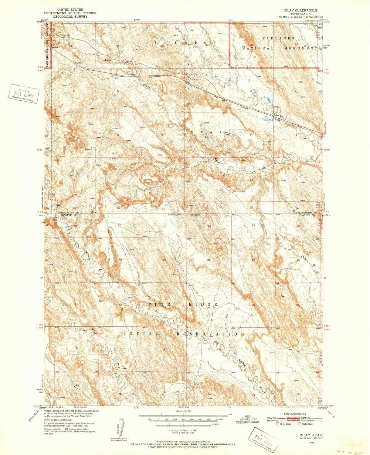
YellowMaps YellowMaps Imlay SD topo map, 1:24000 Scale, 7.5 X 7.5 Minute, Historical, 1950, Updated 1952, 27 x 21.9 in - Polypropylene
YellowMaps

YellowMaps Imlay SD topo map, 1:24000 Scale, 7.5 X 7.5 Minute, Historical, 1950, Updated 1952, 27 x 21.9 in - Polypropylene

$ 519.26
Pseudo Checkbox Icon
Order within 0 hours and 0 minutes to get between -
Buying Bulk?
Delivery Truck IconTracked Shipping on All Orders Secure Payments
Headphones Icon 24/7 Customer SupportReturn Product Arrow Icon14-Day Returns
Description
  • Printed on Polypropylene (plastic)
  • USGS topographic map of Imlay, SD, at 1:24000 scale. Heavier material. Waterproof. Tear-resistant. Foldable. Perfect for the outdoors.
  • Cities, towns, villages: Imlay
  • Islands: Consult topo map preview for visible islands.
  • Parks and forests: National Parks, National Forests, etc. Please preview map image for specifics.


Printed on Polypropylene